bus stop
Cachoeira Paulista, SP
About this place
Discover Cachoeira Paulista, SP
Cachoeira Paulista
Cachoeira Paulista is a municipality located in the Vale do Paraíba region of São Paulo, Brazil. Situated at an altitude of 521 meters, the town covers an area of 287.99 km² and, as of 2010, had an estimated population of 30,091 residents, resulting in a population density of approximately 104.49 inhabitants per square kilometer. (cachoeirapaulista.sp.gov.br)
Geographical Setting
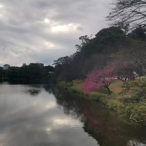
The town is positioned at 22°39'54" S latitude and 45°00'34" W longitude, placing it within the southeastern region of Brazil. It shares borders with the municipalities of Cruzeiro to the north, Silveiras to the east, Lorena to the south and west, and Canas to the southwest. The Paraíba do Sul River, a significant waterway in the region, flows through the municipality, contributing to its fertile lands and historical importance. (cachoeirapaulista.sp.gov.br)
Historical Background
The area now known as Cachoeira Paulista was originally inhabited by the Puris indigenous people, who established a village between the Paraíba do Sul River and the Mão Fria spring, the latter now referred to as Jardim da Fonte. The first colonial settlement began around 1730, under the jurisdiction of the Vila de Lorena, and was named Arraial do Porto da Caxoeira. A pivotal moment in the town's history occurred in 1780 when a small chapel was constructed in honor of Senhor Bom Jesus da Cana Verde. This chapel served as the nucleus for the settlement, leading to its expansion and development. (cachoeirapaulista.sp.gov.br)
In 1822, during the events leading up to Brazil's independence, Prince Regent Dom Pedro I passed through the area on August 18. During his journey from Rio de Janeiro to Santos, he and his entourage stopped in the settlement, where they exchanged mules for horses purchased from local farmers. This event underscored the strategic importance of the town as a transit point for travelers and goods. (cachoeirapaulista.sp.gov.br)
The settlement underwent several administrative changes over the years. In 1876, it was recognized as the Parish of Santo Antônio da Bocaína, and in 1880, it was elevated to the town of Bocaína. The name was changed to Cachoeira Paulista in 1948, reflecting its growing significance and identity within the region. (cachoeirapaulista.sp.gov.br)
Economic Development
Historically, the economy of Cachoeira Paulista has been closely tied to agriculture, particularly coffee cultivation. Its strategic location along key trade routes facilitated the transport of coffee and other goods, contributing to its economic prosperity. The arrival of the Dom Pedro II Railway in 1871 further integrated the town into national and international trade networks, enhancing its role as a commercial hub. The construction of the Cachoeira Paulista Railway Station, inaugurated in 1877, was a significant event, marking the town as a central point for coffee exportation. (es.wikipedia.org)
In the late 1970s, the establishment of the Canção Nova Community introduced a significant religious tourism component to the local economy. This community, known for its religious events and media presence, attracted visitors from across Brazil and beyond, providing a new avenue for economic development and cultural exchange. (chaocaipira.org.br)
Cultural and Architectural Highlights
Cachoeira Paulista boasts several cultural and architectural landmarks that reflect its rich history. The Igreja Matriz de Santo Antônio, dedicated to the town's patron saint, is a notable example of colonial-era architecture. The church's design and construction reflect the artistic and cultural influences of the period, serving as a testament to the town's historical significance. Additionally
Location