
museums
Umm el-Jimal UNESCO World Heritage Site
Umm el-Jimal
Audio guide Listen to the audio guide for Umm el-Jimal UNESCO World Heritage Site Tap to listen in Voicemarks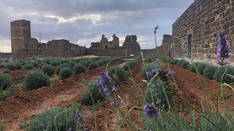
Umm el-Jimal
Umm el-Jimal, situated in northern Jordan near the Syrian border, is a remarkable archaeological site that offers a comprehensive glimpse into the region's rich and diverse history. The settlement developed organically on the site of an earlier Roman settlement around the 5th century CE and functioned until the end of the 8th century CE. (whc.unesco.org)
Historical Overview
The earliest structures uncovered at Umm el-Jimal date back to the 1st century CE, when the area formed part of the Nabataean Kingdom. The Nabataeans were renowned for their advanced water management systems and rock-cut architecture, which laid the foundation for the subsequent development of Umm el-Jimal. With the arrival of Rome in the second century AD, the village eventually became part of the Limes Arabicus—the line of garrisoned forts that protected the Roman province of Arabia. Despite this integration, Umm el-Jimal's inhabitants maintained a degree of autonomy, preserving their local traditions and architectural styles. (ummeljimal.org)
By the 5th and 6th centuries, during the Byzantine period, Umm el-Jimal had transformed into a prosperous town, with estimates suggesting a population of around five thousand residents. This period marked the construction of numerous churches, indicating the town's religious significance and diversity. The settlement's strategic location and agricultural productivity contributed to its prosperity, making it a vital center in the region. (ummeljimal.org)
Architectural Significance
Umm el-Jimal is renowned for its distinctive basaltic architecture, characteristic of the Hauran region. This style reflects local building traditions rooted in pragmatism, cost-effectiveness, and durability. The town's urban layout comprises clusters of multi-storey houses with courtyards, arranged in three neighborhoods. The settlement included sixteen churches of different types, highlighting its religious diversity and significance. Notably, some earlier Roman military buildings were repurposed during the Byzantine period, showcasing the resilience and adaptability of local traditions. (whc.unesco.org)
The settlement formed part of a broader agricultural landscape that included a complex water catchment system, composed of a network of reservoirs and channels connecting the settlement to the nearby wadi, that ensured irrigation of the fields. This sophisticated system underscores the inhabitants' advanced understanding of water management and their ability to adapt to the arid environment. (whc.unesco.org)
Cultural and Religious Diversity
A rich epigraphic corpus in Greek, Nabataean, Safaitic, Latin, and Arabic uncovered on the site and spanning many centuries provides insights into its history and sheds light on the changes in its inhabitants’ religious beliefs. These inscriptions offer valuable information about the social and cultural dynamics of the settlement, reflecting the interactions between different cultures and the evolution of religious practices over time. (whc.unesco.org)
Decline and Abandonment
By 900 CE, the town was abandoned. The exact reasons for this decline remain uncertain, but it is likely due to a combination of factors such as plague, drought, earthquakes, and other environmental or social challenges. The abandonment of Umm el-Jimal reflects broader patterns of urban decline in the region during this period. (en.wikipedia.org)
Rediscovery and Archaeological Significance
Umm el-Jimal was rediscovered in the 19th century, during a time of Western interest in antiquities. The first systematic survey was completed by the Princeton University Expedition to Southern Syria in 1905 and 1909. The first recorded visit to the site was by William John Bankes (1786–1855
Location
Place details
- Area
- Umm el-Jimal, Umm el-Jimal
- Country
- Jordan